
Field services

FIELD SERVICES
A well-executed field programme is the foundation of successful mineral exploration. At GeoPool, we specialise in delivering comprehensive geological services that span the entire exploration lifecycle, from strategic planning and on-site setup to hands-on fieldwork, data management, and expert interpretation of the results.
Whether you require full-service support or targeted assistance for specific tasks, GeoPool offers flexible solutions tailored to your exploration needs. Our team ensures that every stage is optimised for efficiency, accuracy, and insight.
Responsible exploration
We are committed to responsible exploration practices. GeoPool maintains transparent communication with local communities and authorities, prioritises environmental stewardship, and continuously improves safety protocols. Once in the field, we take every opportunity to engage with local residents in a positive and respectful manner, building trust and fostering collaboration. Our goal is to deliver results that are not only technically sound but also socially and environmentally responsible.
Project launch
Successful exploration begins with thorough preparation. GeoPool ensures that every detail is in place before fieldwork begins by coordinating logistics, securing equipment, and establishing a fully functional field base near the project site.
We work closely with contractors to identify the most efficient and cost-effective ways to execute your exploration plan. Safety is a core value at GeoPool, and it’s integrated into every aspect of our planning and operations.
With GeoPool on board, the launch phase includes:
- Project budgeting
- Establishing a local field base (e.g. accommodation, office, sample processing facility, storage space)
- Reconnaissance site visits and early-stage preparations
- Sourcing local professionals and contractors
- Contractor negotiations and agreements
- Stakeholder engagement
- Developing project-specific safety protocols
- Kick-off meetings for personnel and contractors
Diamond drilling
GeoPool specialises in managing and executing diamond drilling campaigns across the Nordic region. At GeoPool, we recognise that every drilling campaign presents unique challenges that require tailored technical solutions for effective operation. With extensive experience and a deep understanding of local field conditions, we ensure smooth execution by proactively addressing logistical and geological complexities while minimising downtime.
Our services apply to both exploration and active mining projects, supporting clients across different stages of resource development. We combine skilled personnel with specialised equipment to deliver high-quality drilling outcomes. Precise data collection and thorough analysis are central to maximising the value of this capital-intensive phase. Additionally, new insights can be unlocked from archived drill core using modern measurement techniques, enhancing legacy datasets at a relatively low cost.
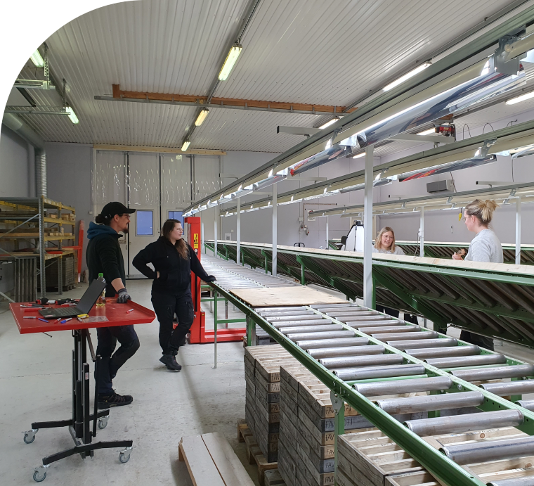
Drill core logging, measurements, and sample handling can be carried out at our Exploration Hub in Sodankylä, Central Lapland, where we have established a streamlined workflow from field to laboratory, ensuring consistency, efficiency, and data integrity throughout the process.
Our diamond drilling services include:
- Planning and organisation of drilling campaigns
- On-site operations management
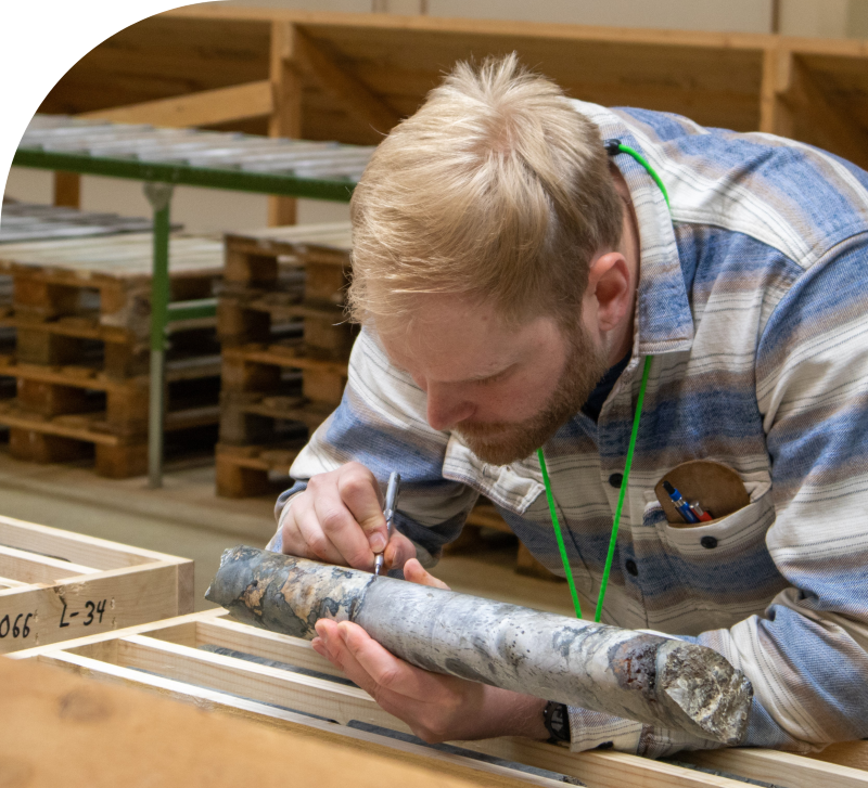
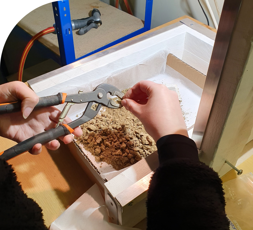
- Geological and geotechnical drill core logging, including structure mapping and Q’ determination
- Measurements on drill core (e.g. pXRF, hyperspectral mineralogy, magnetic susceptibility, conductivity, hardness, density, point-load testing)
- High-resolution drill core photography
- Drill core cutting and sampling for laboratory analysis
- Drill core logistics and storage
- Drilling site inspections and rehabilitation
- Accurate positioning with DGPS, e.g. marking of access routes and drill sites
- Location and verification of legacy drilling sites
- QAQC protocol development and laboratory result validation
- Interpretation of results and recommendations for next steps
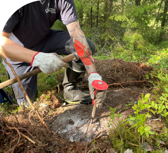
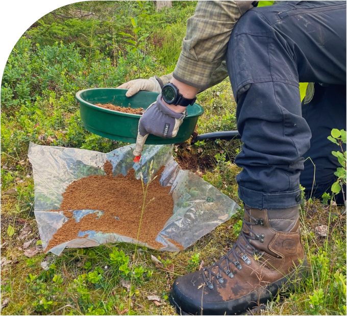
BoT sampling
Base of till (BoT) sampling is a proven and effective exploration method across the glaciated terrains of the Nordics. By extracting a till sample directly above the bedrock, the method provides valuable geochemical and mineralogical insights that reflect the underlying bedrock composition. When combined with top of bedrock (ToB) sampling, a short drill core can also be recovered to verify lithology and enhance geological interpretation.
GeoPool has extensive experience in managing BoT campaigns from start to finish, using a streamlined workflow that ensures operational efficiency and data quality. Sample handling and reporting are carried out at our custom facilities within the Exploration Hub in Sodankylä, Central Lapland.
Our BoT sampling services include:
- Planning and organisation of BoT or ToB sampling campaigns
- On-site operations management
- Till sample logging, with integrated drill core logging in ToB sampling campaigns
- Measurements on till samples (e.g. pXRF, hyperspectral mineralogy, magnetic susceptibility)
- Sample handling and logistics
- Accurate positioning with DGPS, e.g. marking of access routes and sampling points
- QAQC protocol development and laboratory result validation
- Interpretation of results and recommendations for next steps
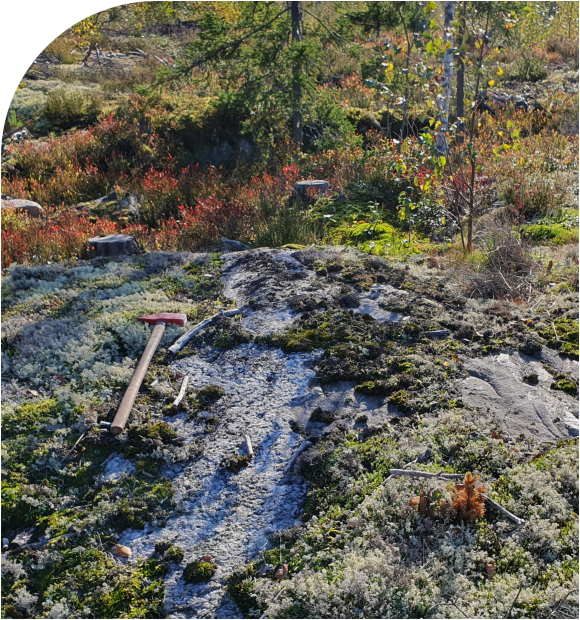
Geological mapping and prospecting
GeoPool’s field-experienced geologists and technicians are skilled in identifying prospective outcrops and boulders. Each mapping campaign begins with thorough desktop studies to ensure that fieldwork is strategically planned and time in the field is used effectively. Mapping resolution is tailored to meet the specific needs of each project, and we can focus on particular themes, such as structural geology, to better understand regional, potentially ore-forming systems in the area.
We collect rock samples from key lithologies and manage the entire sample workflow from field to laboratory. For more systematic sampling needs, we offer mini drilling and channel sampling with a blade saw. Using our portable pXRF and LIBS equipment, we can obtain preliminary geochemical data directly in the field or at the field base, allowing us to refine our focus and direct efforts towards the most promising areas during active campaigns.
Low-impact surface sampling
GeoPool has a long-standing commitment to developing and promoting low-impact exploration methods that minimise environmental disturbance while delivering high-quality data. Each surface sampling campaign is designed to meet the specific needs of the client, incorporating appropriate QAQC procedures and executed by our skilled field teams.
Before sending the samples for geochemical analysis, we can efficiently gather additional information from the samples and generate preliminary analytical results using our portable XRF and magnetic susceptibility equipment, helping to guide exploration decisions in real time. We also manage the sample handling and logistics to ensure smooth operations.
Surficial sampling methods can also be applied to monitor the environmental impact of exploration activities. As projects progress toward the development stage, baseline monitoring becomes increasingly important.
We offer a broad selection of surface sampling methods:
- Geochemical sampling of the unaltered mineral layer using shovel or Auger drill
- Heavy mineral sampling and sample preparation
- Biogeochemical sampling of plant leaves and bark
- Stream sampling of mineral or organic materials
- Sampling for weak/selective leach methods, e.g. MMI
- Surface water sampling for baseline monitoring
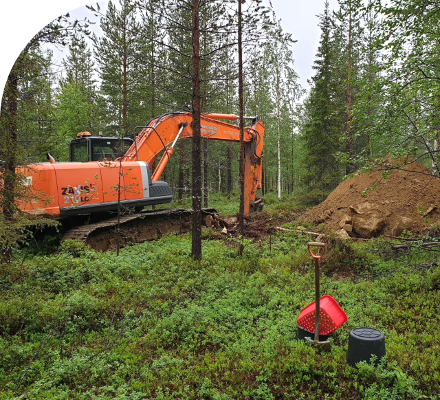
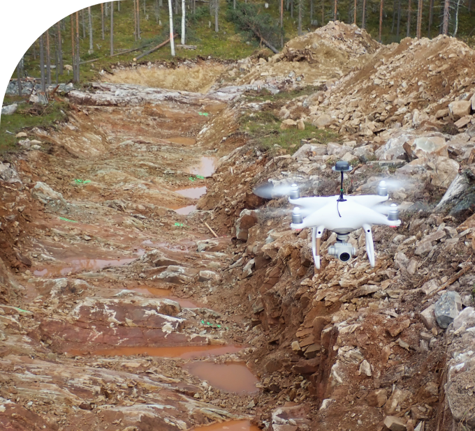
Trenching and pitting
In soil-covered terrains, trenching and pitting, alongside diamond drilling, are among the few methods that allow direct and reliable observation of the bedrock. While inherently invasive, GeoPool has developed workflows that minimise environmental impact and ensure safe, efficient execution. Open dialogue with landowners regarding site preparations, such as tree removal, and post-work rehabilitation is a key component of every trenching operation.
Our experienced excavator contractors and field technicians work under close supervision of our geologists to expose bedrock in a controlled manner that preserves critical geological structures. During the mapping phase, GeoPool applies our efficient mapping method that combines drone imagery with DGPS positioning to produce accurate geological maps of trench exposures. Before the trench is reclaimed, we carry out systematic sampling using our channel sampling tools and mini drill equipment to collect representative rock samples for geochemical or petrographical analysis.
Drone imagery and 3D surface modelling
At GeoPool, our extensive experience in trenching has enabled us to develop a streamlined workflow for high-resolution trench mapping using UAV-based photogrammetry. The resulting aerial imagery enhances the accuracy and detail of geological interpretations, while the generated 3D mesh models provide a clear, desktop-accessible view of site geology.
Our system is also well-suited for documenting bedrock outcrops and rock cuttings, supporting both exploration and structural analysis applications. All imagery is georeferenced using site-specific RTK ground control points, ensuring precise spatial accuracy for mapping and modelling.

CONTACT US
We deliver customised exploration solutions for your company.